Photo by ANZAÏ
About the artwork
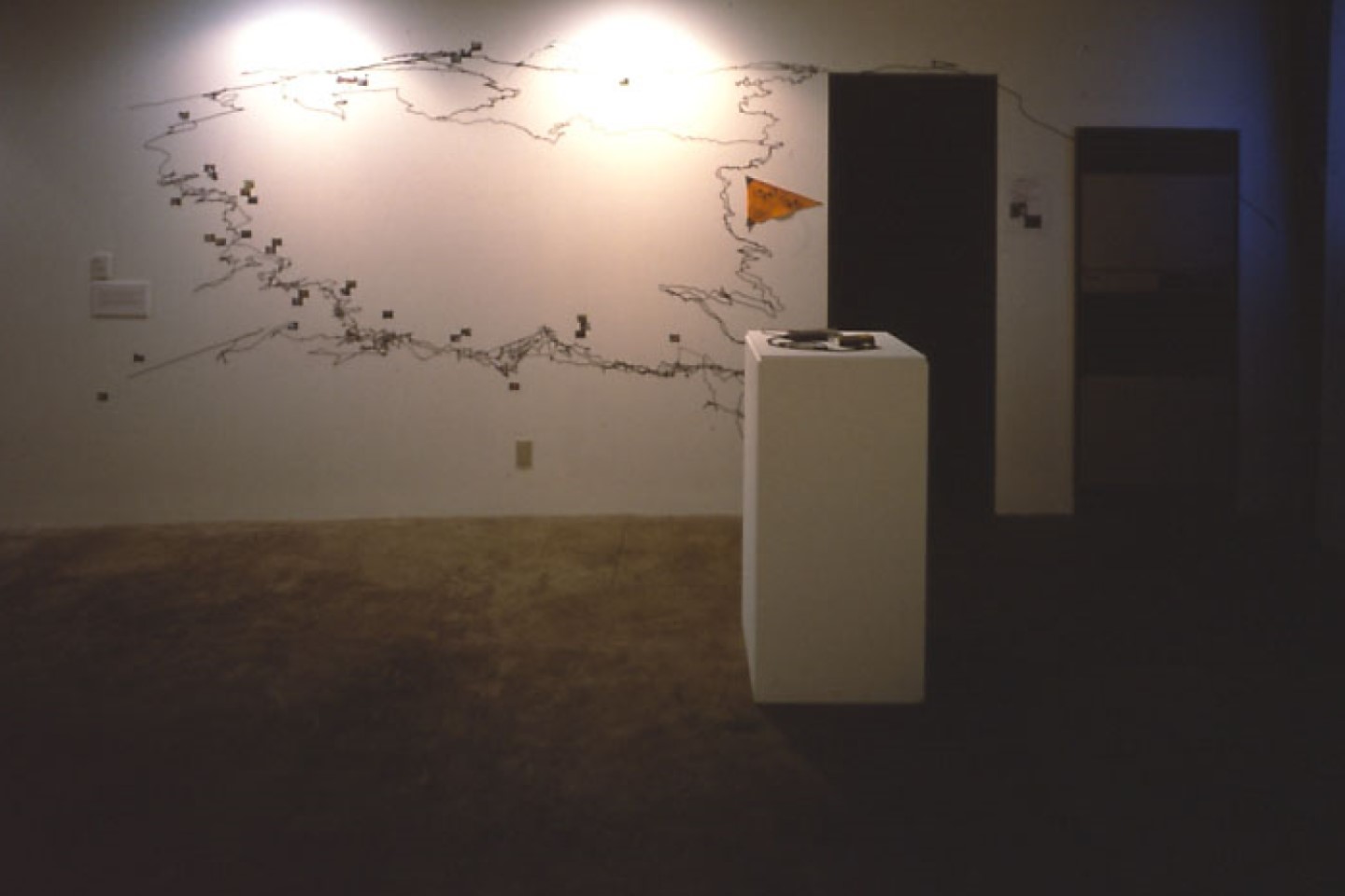
This map of Fujihata’s climb to the peak of Mt. Atema, in Tokamachi, was made with data recorded by a global positioning system. He organized a workshop whose participants divided into teams and sent the location data each collected via cell phone to a personal computer.
Information
| Artwork no. | T004 |
|---|---|
| Production year | 2000 |
| Area | Tokamachi |
| Village | City center |
Articles


Stay In Touch
Stay connected with the ETAT official social media to receive the latest news and event information, and the many seasonal faces of Echigo-Tsumari as well as new issue of the ETAT official media, “Art from the Land”.