
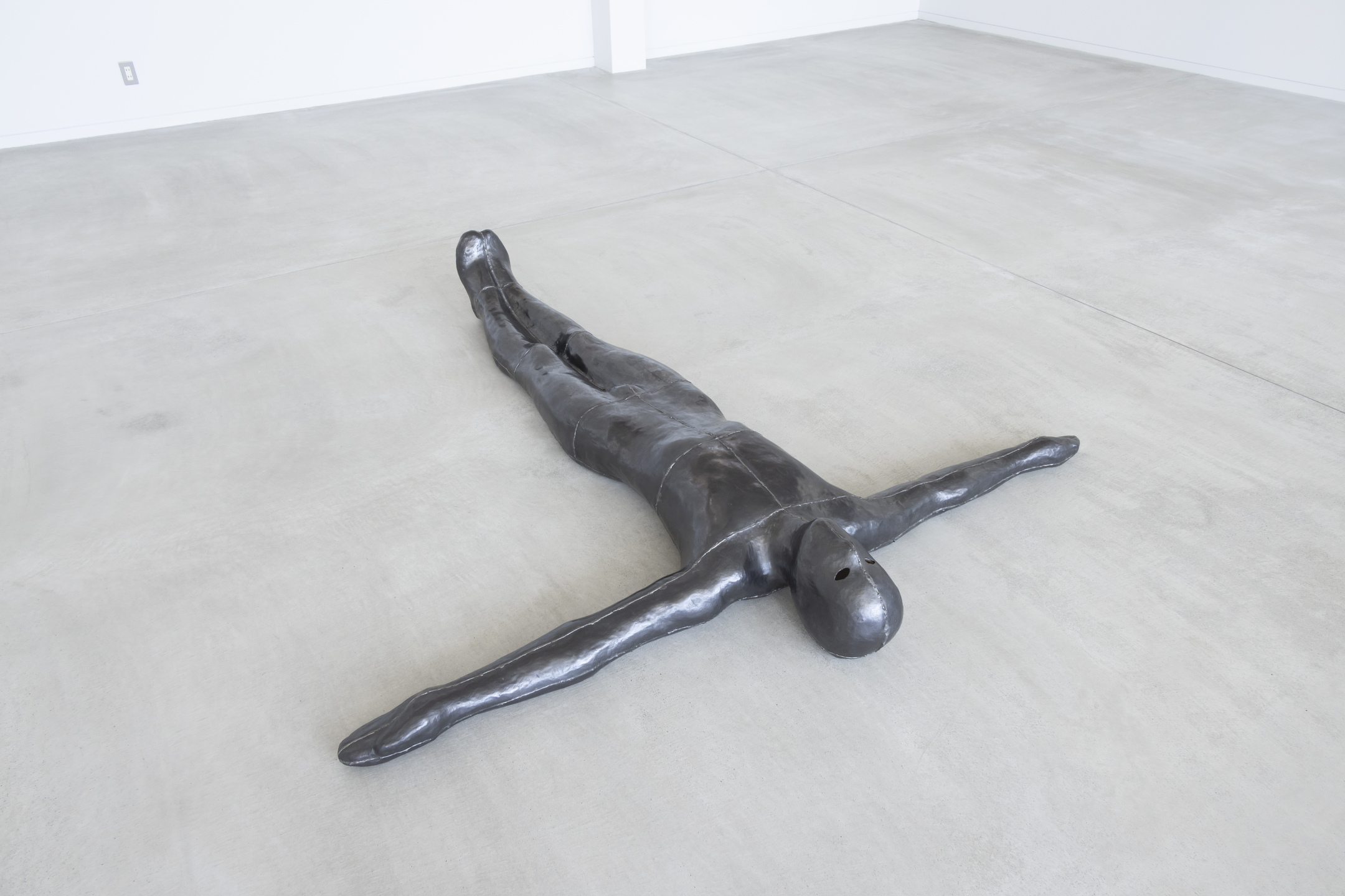
About the artwork
About the artwork
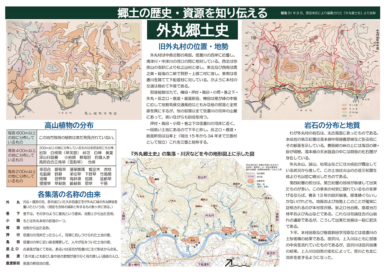
The former Tomura village including Tomura, Tatsunokuchi, and Sanga in Tsunan-town which is one of the heaviest snowfall regions, is located on the western side of the Shinanogawa river. The area includes small terraces that sit between the Shinanogawa river and steep mountains such as Mt Koriyama, Mt Eboshigatayama, and Mt Arikurayama as well as a narrow foothill landform made up of mudslides from steep mountains. The natural environment and regional resources are very different from Shimofunato and Warino areas consisting of the large river terraced. Because of these features, there are many avalanches and landslides. The area was difficult to access but the long-held dreams of the local people have come true, including the construction of the Iilyama Railway Line in conjunction with the Shinanogawa River Power Station project, the opening of a tunnel at Toyohara Pass, a difficult traffic route from Tatsunokuchi to Matsunoyama, and the building snowshed.
The former Tomura settlement included nine villages such as Taruda, Oshitsuke, Shimada, Kooka, Makinoshita, Tomaru, Tatsunokuchi, Shikawatari, and Shikawatari-Shinden. The three villages, Tatsunokuchi, Shikawatari, and Shikawatari-Shinden, located in the northern part of the former Tomura settlement were historically independent as Sanga village from 1882 to 1901 and thus they are collectively referred to as “Sanga”.
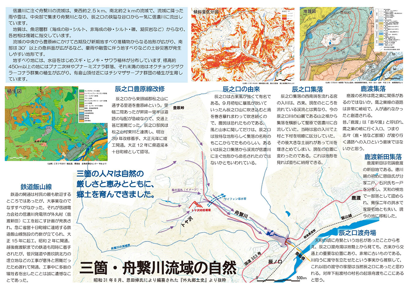
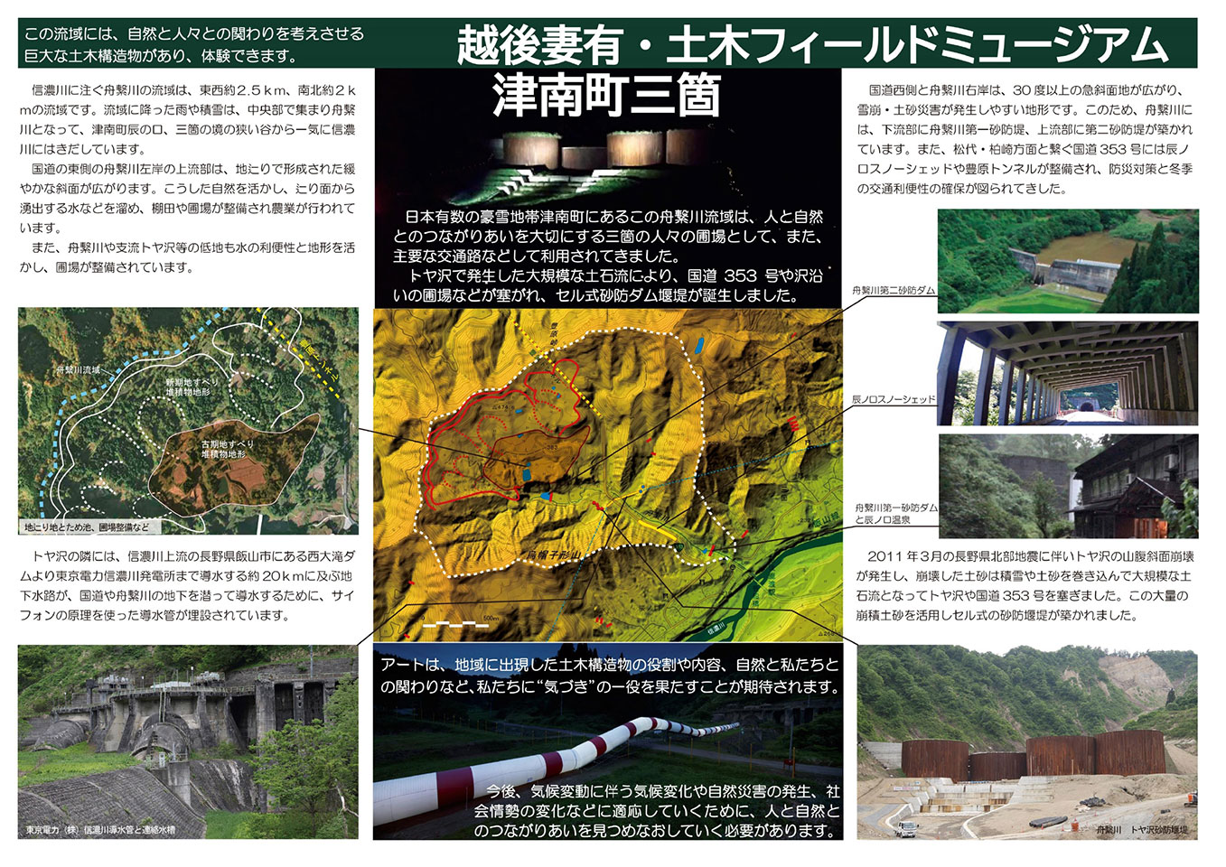
The Funatsunagigawa River streaming into the Shinanogawa River in Sanga runs 2.5km east-west and 2km north-south and rains and snow fall in the river basin gathered in the centre and turned into the Funatsunagigawa River, flowing out of the narrow valley mouth at Tatsunokuchi into the Shinano River at once. The valley-floor plains and gentle slopes of the old landslide terrain in the basin have been used by people in Sanga for cultivation from early on. It is also the key location connecting east and west on Route 353.
Tatsunokuchi located at the exit of the Funatsunagigawa River to the Shinanogawa River has been known for strong wind for a long time ago. There is also a record in the “Tomaru Local History” which reads “Farmers were afraid of the stormy wind in early September. Once it blew into Mount Tatsunokuchi, it continued to whirl and blow wildly.” As far as wind and mountain water go, Tatsunokuchi seems to have a unique topography which the name of the village originated from. Or, others say it was named after the topographical shape of the terrain where the stream flows into the Shinanogawa River from Tatsunokuchi village.
Such a relationship between the harsh natural environment of this area and people’s lives are recorded in the ‘Tomaru Local History’ (August 1956, edited by Onda Taku) as evidence of the formation of the area’s distinctive culture, and is passed down to the present day.
The relationship between the harsh nature and people as well as the adaptation to co-exist with nature have been ongoing to date. In order to avoid and mitigate natural risks triggered by climate change and to adapt to nature in alternative ways, we need to learn from the wisdom of our ancestors, make use of it, pass it on, and share it with those who are living in the present to create sustainable communities.
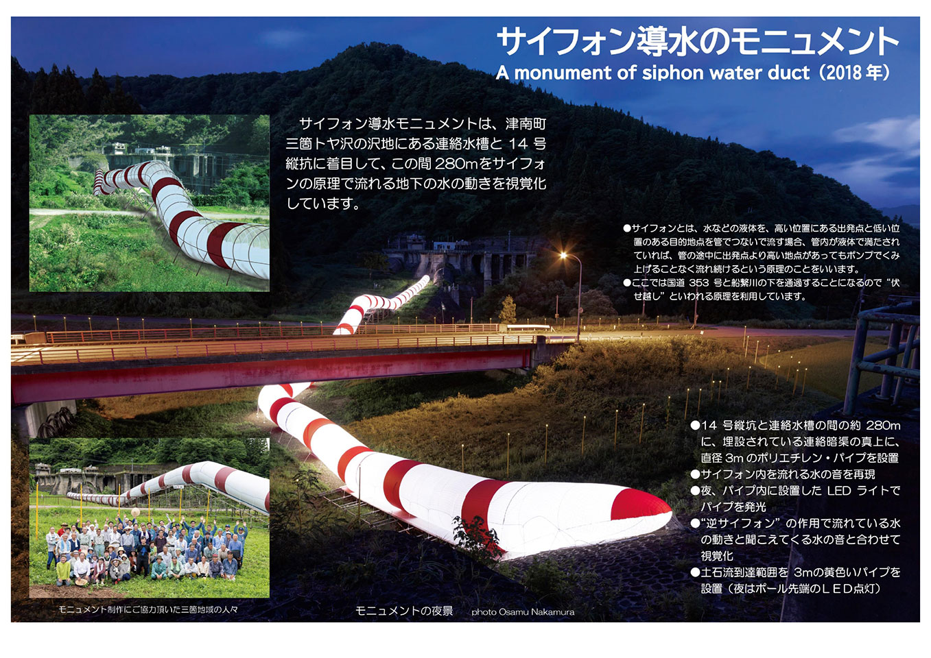
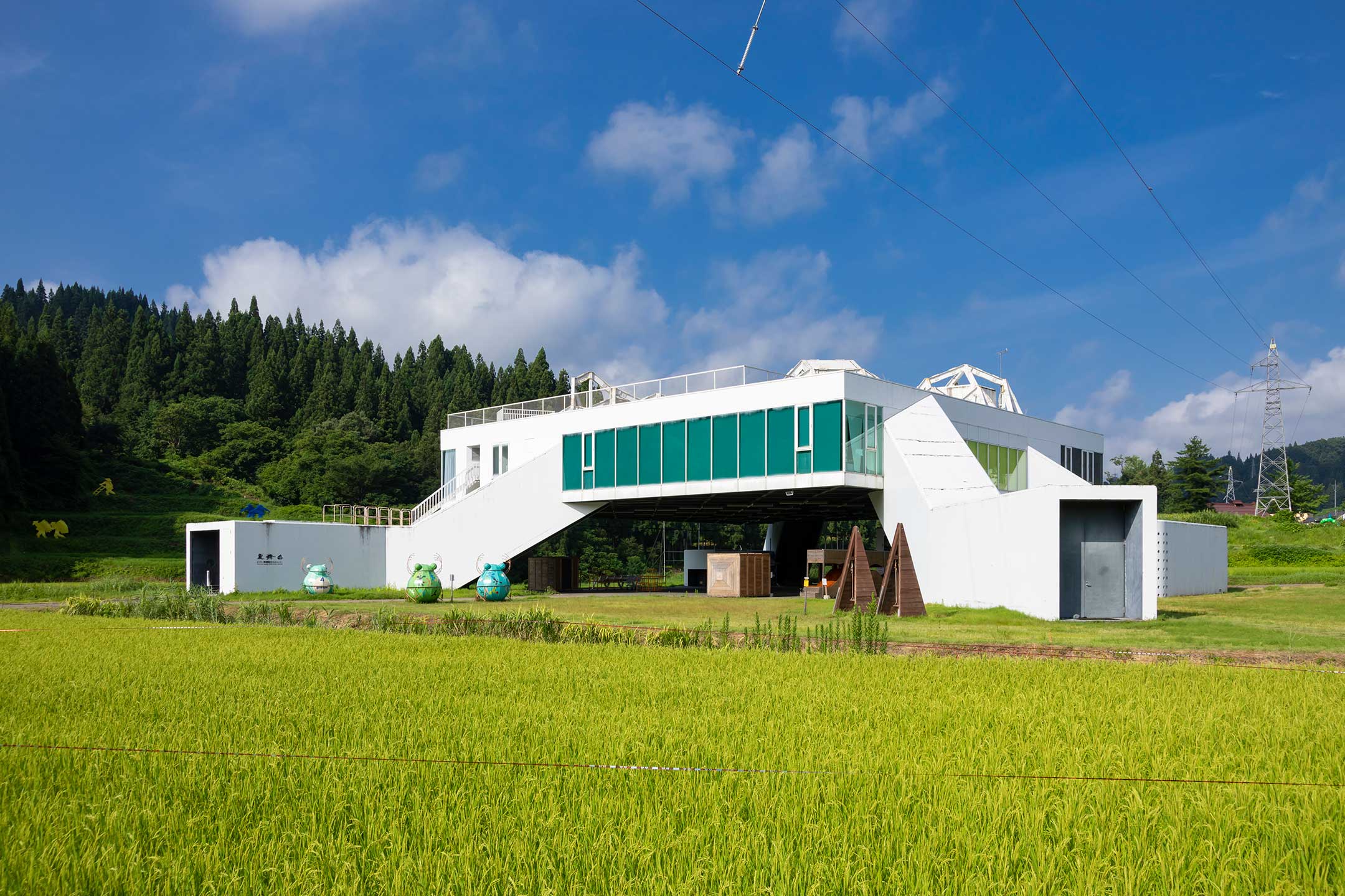
There is a 6 m diameter underground canal in the basin of the Funatsunagigawa River which runs water taken from Nishiotaki dam in the Iiyama City, Nagano Prefecture, located at the upper stream of the Shinanogawa River, for 20 km till reaching Shinanogawa Power Station, Tokyo Electric Power Company. At Sanga Tatsunokuchi, in order to cross the 260 m streambed, two U-shaped underground channels, which utilise the siphon principle, are culverted to conduct 90 tonnes of water per second.
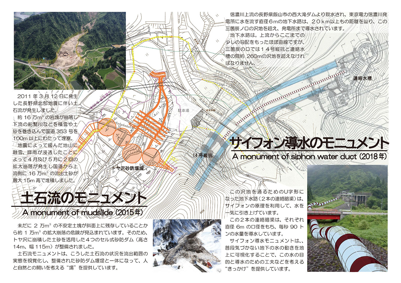
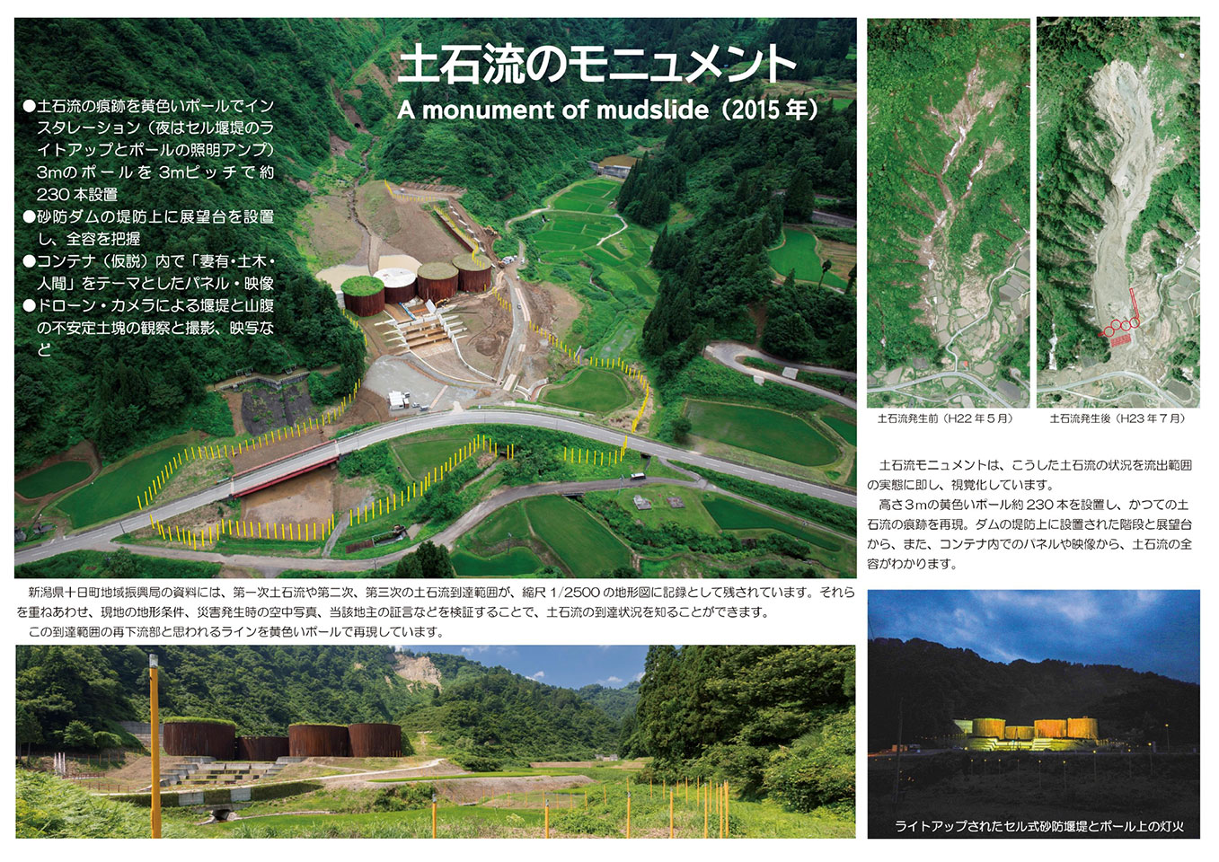
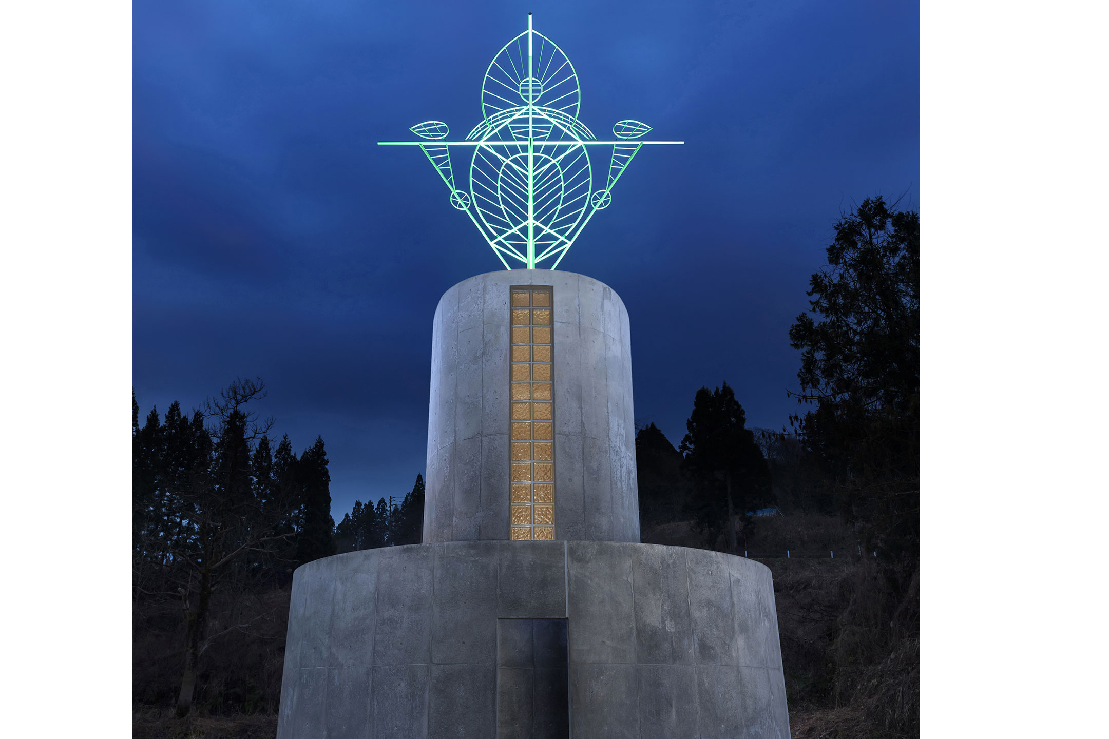
Moreover, the Northern Nagano Earthquake on 12 March 2011 caused a massive mudslide, approximately 160,000 ㎥of rock to collapse, entangling snow and sediment and burying the Funatsugigawa River and Route 353 for over 100 m. Because 20,000 ㎥of unstable earth mass are still left on the slopes, four cellular erosion control dams (14 m high and 115 m wide) were constructed to utilise the sediment that collapsed in the Toya stream.
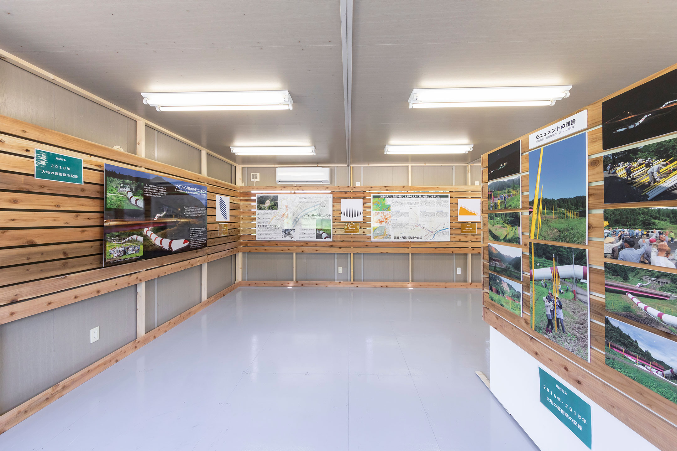
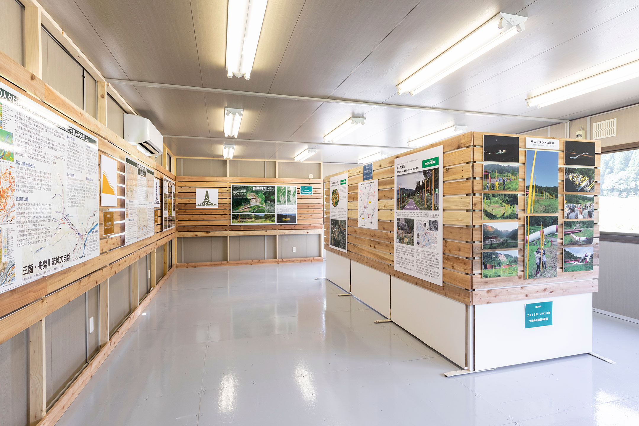
I created “A monument of mudslide” in 2015 in order to provide a “place” to consider the battle between humans and nature as viewers see visualised conditions of the mudslide and the actual extent of spillages while they stand on the improved erosion dam weirs.
I also presented “A monument of siphon water duct” in 2018 to offer a chance to consider the purpose of water and innovations for water conduits by revealing the movement of water underground, which is usually unnoticed with reference to the buried siphon conduits.
This project aims to learn about the history and nature of the place, pass information to the next generations and thus contribute to the creation of new culture, by presenting the briefings of the artworks “A monument of mudslide” in 2015 and “A monument of siphon water duct” in 2018 as well as the content of the “Tomaru Local History” in panels.
Information and Map
| Artwork no. | M071 |
|---|---|
| Production year | 2022 |
| Opening hours | Daytime |
| Admission | ー |
| Area | Tsunan |
| Village | Sanga |
| Venue | Sanga Otsu, Tsunan-cho, Naka-uonuma-gun, Niigata Prefecture |
Articles

Stay connected with the ETAT official social media to receive the latest news and event information, and the many seasonal faces of Echigo-Tsumari as well as new issue of the ETAT official media, “Art from the Land”.